 aps were once one of the most prized possessions of a navigator. Going back to the time of the Romans, having a map of your surroundings or your enemies’ holdings was vital in gaining an upper hand. As we progressed, trade became more important, and therefore it was crucial for countries with sea access to be able to efficiently and safely navigate the waters of the world. Many maps made at the time held their country’s capital as its center, something we would later call the “Prime Meridian.”
Many if not all modern maps are now centered around the Prime Greenwich Meridian, sometimes referred to as simply the Greenwich Meridian. This line splits up our world, passing through the Royal Observatory of Greenwich in London, England. Using this point of reference as the Prime Meridian goes back to the 19th century when it was established as the central point of all maps made by the 22 biggest world powers in 1884. This begs the question, why was this decision made?
The Need to Standardise
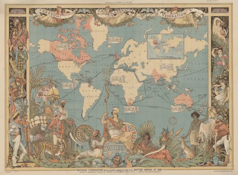
Colonialism was in full swing throughout the 1800s, something which led to the demand for maps to skyrocket. Maps became the central tool for many institutions during this century, especially traders who took advantage of the new colonial holdings of the European powers to make themselves rich. England was at the head of the colonialism push of the 1800s being at the peak of their power with India, Canada, Australia, and South Africa being under their control.
For traders within the empire, exchanges were easy. Most maps held by British navigators were centered around London, which meant that collaboration was easily achieved. This meant that exact locations using coordinates could be used to set up for exchanges between traders with the decreased risk of any confusion arising. This was much more complicated when trading outside of the empire.
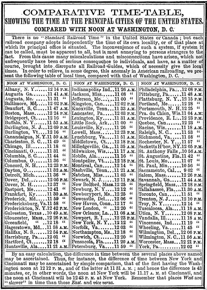
Timekeeping was also now more important than ever. Due to the industrial revolution, commercial trains started to be used almost daily by commuters or travelers. Making sure that these trains would get to their destination on time was crucial.
This posed many problems, especially in the USA, where tens of time zones existed, making timekeeping nearly impossible. Standardizing the time would change this forever.
The International Meridian Conference
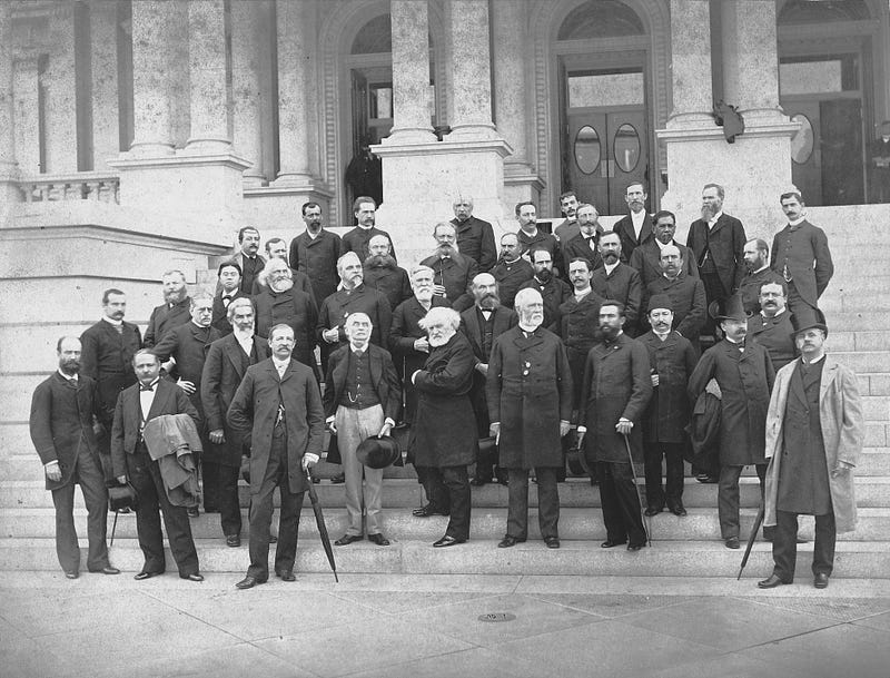
This need for standardization culminated in October 1884 when the International Meridian Conference was held in Washington D.C. Here 25 of the world’s most influential countries were invited to send their delegates over to resolve the problem of a Universal Prime Meridian as well as other problems which concerned the standardization of time.
On October 22, after 22 days of long debate, several decisions were made, the most important being on the placement of the Universal Prime Meridian.
“[The] Conference proposes to the Governments here represented the adoption of the meridian passing through the centre of the transit instrument at the Observatory of Greenwich as the initial meridian for longitude.”
This decision passed with 22 out of the 25 countries agreeing to it. The only country to disagree with the decision was the Dominican Republic, with France and Brazil abstaining from voting (for anyone who knows French history, it shouldn’t be surprising to see the French not agreeing with a decision that favored the English).
One main reason for the French abstaining from voting for Greenwich to become the Prime Meridian was because they believed that the Prime Meridian should be put in a place of neutrality.
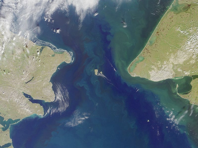
Many suggestions were given for such a place, the two most famous examples being the Bering Straits (the northern part of the Pacific which splits the USA from Russia) and the Azores (a Portuguese island chain roughly 1,500km west of Lisbon) but this proved to be unpopular with the other members of the conference.
This decision made just over 100 years ago still has an impact on us today. We still use Greenwich as our prime meridian, and many satellite systems rely on this universal system to function properly. If this standardization never took place, having such advanced systems of navigation would be nearly impossible.
This is a prime example of how history impacts us every day. The deeper we dig, the more connections we can make between our everyday lives and the decisions of our ancestors. It is best to look back ever so often and learn from what our ancestors did.

Student of Philosophy, Politics and Economics. History fanatic. Contact: aneculaeseicg@gmail.com